The Isle of Spice
Grenada
Quick Facts
About Grenada
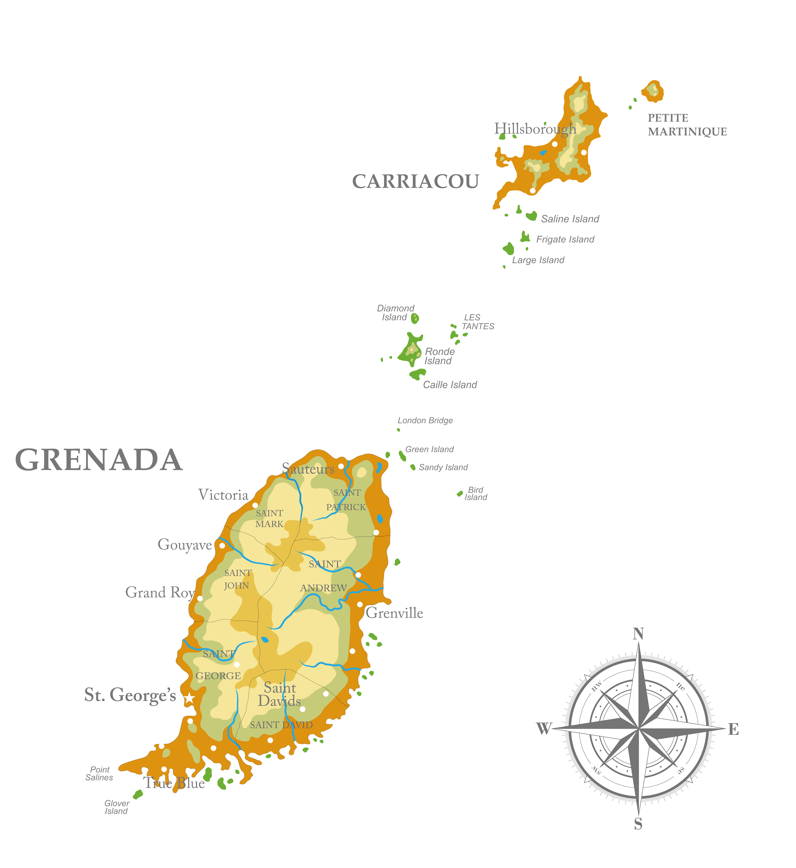
The State of Grenada consists of three islands- Grenada, Carriacou and Petite Martinique which form the southern end of the Windward Islands. Formerly colonized for many years, first by the French and then by the British.
The islands of Grenada still retain traces of these European influences in their culture, architecture and place names. The Capital, St. George’s, is located on the south west coast of Grenada. It is the seat of government and the main commercial centre.

Population
125,438 (2022)

Location
12°07′N 61°40′W

Time Zone
EST+ 1; (GMT – 4:00)

Language
English (Official)

Currency
Eastern Caribbean dollars (XCD)

Climate
Tropical – avg. temp 79.682ºF (26.49ºC) (2020)

Capital
St. George’s (est. pop. 33,734) (2012)

Major Religion
Christianity
History
Before the 14th century, the Caribs, who displaced the earlier population of Arawaks, settled in Grenada. During his third voyage to the new world in 1498, Christopher Columbus sited the island and named it Concepción. The origin of the name “Grenada” is ambiguous, but Spanish sailors likely renamed the island for the city of Granada in Spain. The French then adapted Granada to Grenade, and the British followed suit, changing Grenade to Grenada.
European settlement was slow to follow due to the fierce resistance of the warlike Caribs. The island remained uncolonized for more than 150 years, although Britain and France fought for control. The French gained control of the island in 1672 and held on to it until the British successfully invaded the island in 1762 during the Seven Years’ War and acquired Grenada by the Treaty of Paris in 1763. Although the French regained control in 1779, the Treaty of Versailles restored the island to Britain in 1783.
During the 18th century, the British established sugar plantations, and slave labour was brought in from Africa to work on the estates. Natural disasters in the late 18th century destroyed the sugar fields and paved the way for the introduction of other crops. The British introduced cacao, cotton, nutmeg and other valuable spices, and Grenada assumed a new importance to European traders.
Slavery was outlawed in 1834, at which point the slave population had reached 24,000. National political consciousness took shape through the labour movement. Grenada joined the Federation of the West Indies in 1958. When that was dissolved in 1962, Grenada evolved first into an Associated State with internal self-government (1967). Independence was achieved from the United Kingdom in 1974; Grenada became a constitutional monarchy, with a Prime Minister and Queen Elizabeth II as Head of State, represented by the Governor General.
Grenada's
Geography
-
The State of Grenada lies between Trinidad and Tobago to the south and St. Vincent and the Grenadines to the north in the Eastern Caribbean. It is the southern-most of the Windward Islands. It is 100 miles north of Venezuela, 158 miles south west of Barbados.
-
Grenada is 12 miles (18km) wide and 21 miles (34km) long, and covers a land area of 120 sq. miles (440 sq. km), Carriacou is 13 sq. miles (34 sq. km) and Petite Martinique is 486 acres (194 hectares).

